

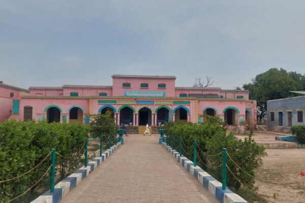
208. The Great Trigonometrical Survey of India: St. John’s Church, Jhelum.
In my previous blog, I took readers on a tour of a beautiful and historic church in Jhelum called St. John’s Church. As I mentioned in that post, my interest in visiting this church was driven by a commemorative plaque installed inside the church to honour 36 British soldiers killed during the Mutiny of 1857. However, this visit on November 10, 2025, proved to be much more interesting and full of learning and new experiences.
GTS Survey Mark:
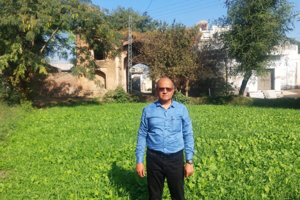
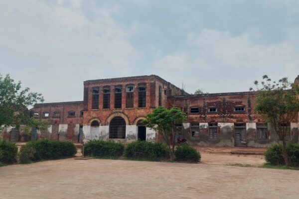
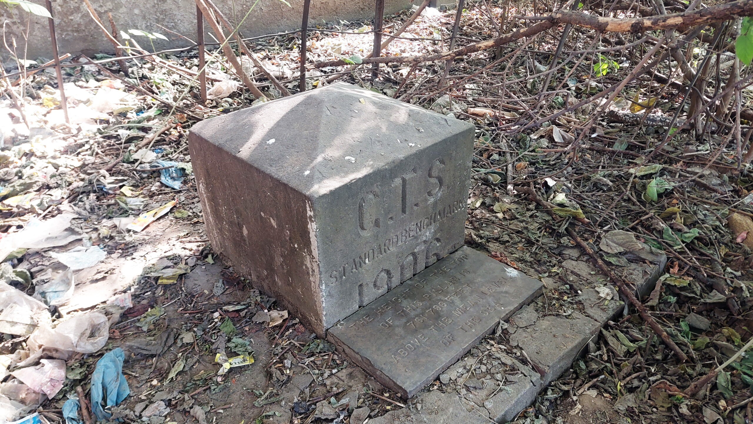
Besides many other interesting discoveries, I came across something that I neither expected nor even knew existed. All the credit goes to Babu Shafiq Gill sahib, the Assistant Pastor of the church. When we told him the purpose of our visit, he welcomed us warmly and said that before taking us on a tour of the church, he wanted to show us something else. He led us to a corner of the vast compound, hidden behind trees and bushes. There, he pointed out a very important landmark.
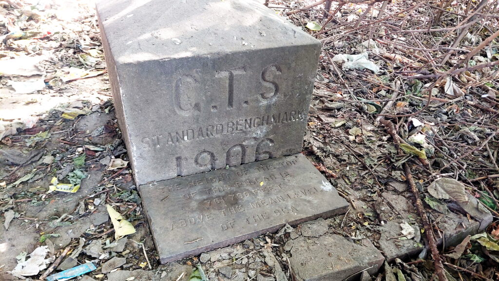
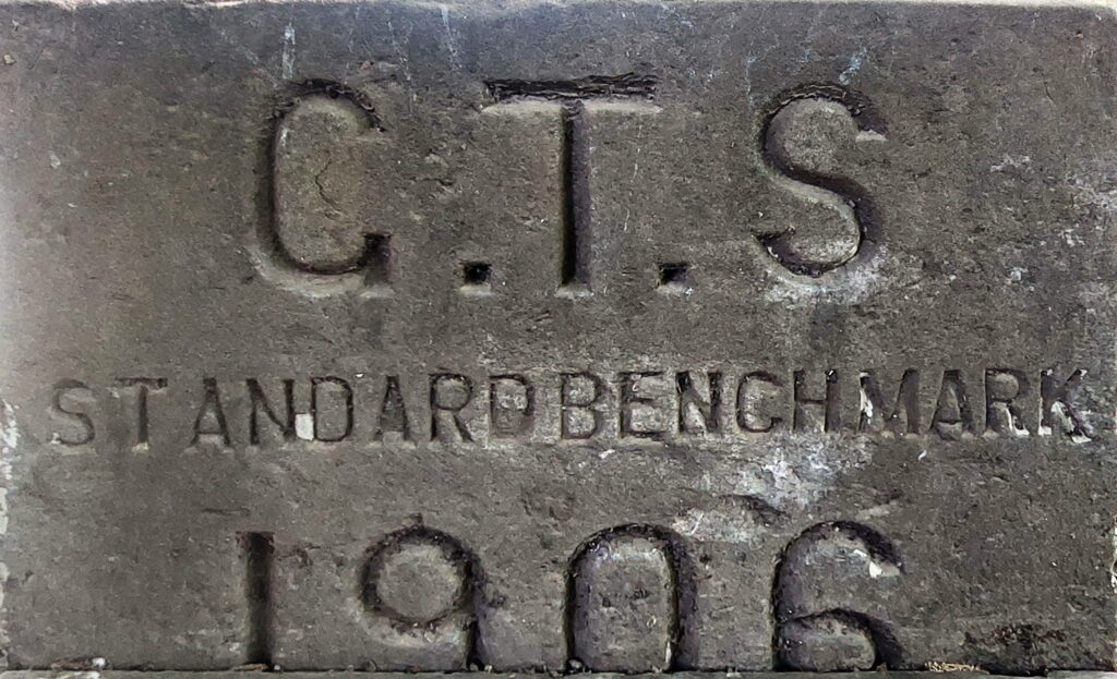
An inscription on a pillar-like structure revealed that it was a survey mark, and three bold letters—GTS—stood for the Great Trigonometrical Survey of India. This was a fascinating discovery. I had read about this great survey but had never imagined that its physical landmarks still existed. This benchmark is located at 32°55’18.65″N, 73°43’22.26″E.

(Great Trigonometrical Survey)
STANDARD BENCHMARK
1906*
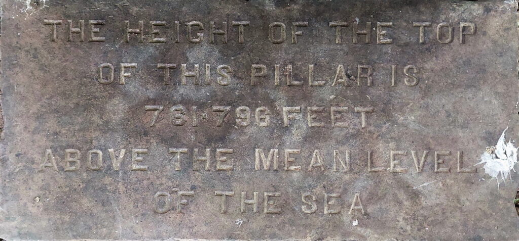
OF THIS PILLAR IS
781.796 FEET
ABOVE THE MEAN LEVEL
OF THE SEA
Just out of curiosity, I checked the height of the area around the church on Google Earth, which shows an elevation of 858 feet. The difference of about 76 feet is quite significant, and I could not find a clear explanation for it.
Churches as Survey Points in the Nineteenth Century
Churches were frequently used as survey points during the nineteenth century because they combined several practical advantages essential for accurate surveying. They were usually solid, permanent masonry structures intended to last for generations, making them reliable reference points. Many churches, especially in British cantonments, featured tall towers or steeples that were clearly visible from long distances, an important requirement for triangulation surveys. Their central and well-documented locations meant they appeared on official maps, while their association with military or civil administration ensured security and controlled access. Churches were often built on slightly elevated ground with open surroundings, further improving visibility. For these reasons, they were ideal locations for placing survey benchmarks and height reference marks, such as those used during the Great Trigonometrical Survey of India.
A Standard Benchmark
A standard benchmark in the Great Trigonometrical Survey of India was a fixed point used for accurate measurement of heights and distances. These benchmarks were established at different locations. So that surveyors could refer to them while mapping the land. They were crucial for maintaining precision in the survey.
The benchmarks were marked carefully, sometimes with inscriptions or metal plates, showing the exact height above a reference point, usually mean sea level. Surveyors used these benchmarks as starting points for their measurements, ensuring that all calculations of elevation and distance were consistent across the region.
These standard benchmarks played a key role in the success of the Great Trigonometrical Survey. By providing reliable reference points, they allowed surveyors to measure large areas accurately and create detailed maps. Even today, some of these benchmarks still exist and are recognized as important historical survey markers.
Source: Wikipedia
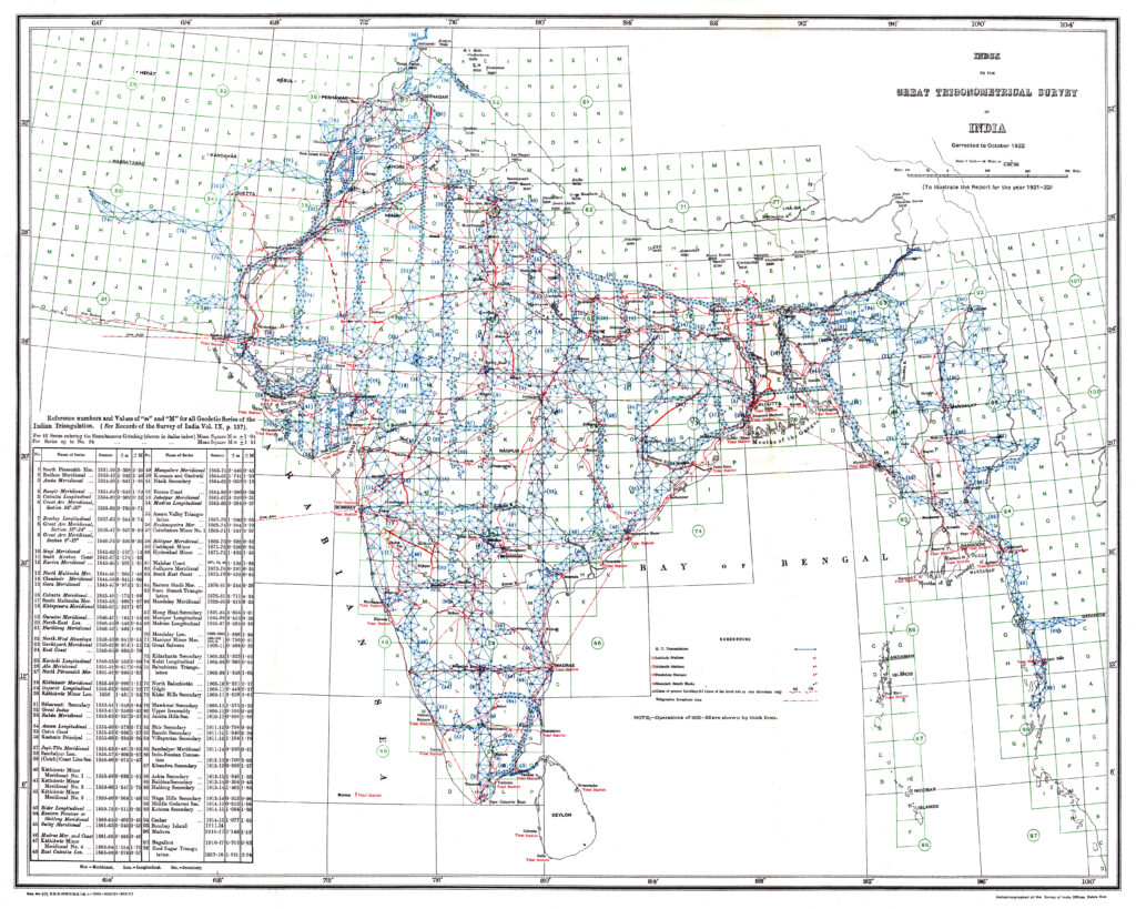
It is interesting to note that in the above given map the Jhelum city is marked with a symbol denoting a “Standard Bench Marks”.
Great Trigonometrical Survey
The Great Trigonometrical Survey of India (GTS) was one of the most remarkable scientific and surveying projects undertaken in the nineteenth century. It laid the foundation for accurate mapping of the Indian subcontinent and played a crucial role in the development of modern surveying and geography in South Asia.
The survey began in 1802 under the leadership of Colonel William Lambton, an officer of the East India Company. The initial aim was to measure a long chain of triangles from southern India northwards in order to determine accurate distances and positions. After Lambton’s death in 1823, the work was continued and greatly expanded by Sir George Everest, after whom Mount Everest was later named. Despite difficult terrain, extreme climate, dense forests, and health risks, the survey continued for several decades and was largely completed by the mid-nineteenth century.
One of the greatest achievements of the Great Trigonometrical Survey was the precise measurement of the Himalayan peaks, including the identification of the world’s highest mountain, later named Mount Everest (Peak XV). The survey also produced the most accurate measurements of the Indian meridian, the size and shape of the Earth in this region, and the relative heights of mountains and plateaus. Advanced instruments such as the Great Theodolite were used, and highly refined mathematical calculations were applied, making the survey a scientific landmark of its time.
The significance of the Great Trigonometrical Survey of India is immense. It provided a reliable geographical framework for maps, administration, infrastructure development, and defense planning. It also contributed valuable data to global geodesy and improved the understanding of the Earth’s curvature. Beyond its scientific value, the GTS stands as a testament to human perseverance and precision, carried out under extremely challenging conditions. Its legacy continues to influence modern surveying and cartography in the region.
In conclusion, the Great Trigonometrical Survey of India and St. John’s Church, Jhelum, are closely linked with the scientific and historical past of this region. The church was not only a place of worship but also part of the wider colonial setting in which surveyors and officers lived and worked while carrying out the great task of mapping India. Understanding this connection helps us appreciate the historical importance of St. John’s Church and reminds us of the need to protect and preserve such heritage sites for future generations.
Babu Shafiq sahib, informed me that government officials still come to visit this benchmark, in connection with their official task related to survey. Hence, it has not lost its signficance and importance even the passage of more than a century.
Babu Shafiq Sahib informed me that government officials still visit this benchmark in connection with their official survey work. Hence, it has not lost its significance and importance even after the passage of more than a century. This clearly shows the lasting practical value of this historic benchmark.
Tariq Amir
December 15, 2025.
Islamabad


Tariq Amir’s love for Pakistan is quite vivid in his work. He is deeply in love with any historical land mark no matter who built it and who destroyed it. You will find him all the time wondering in Pakistan and bringing these long forgotten and trodden, tiny or huge landmarks or castles, back to life. Well done bro 👊
Thank you shah ji.