Geographic / Demographic
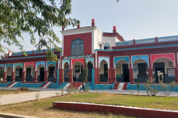
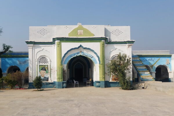
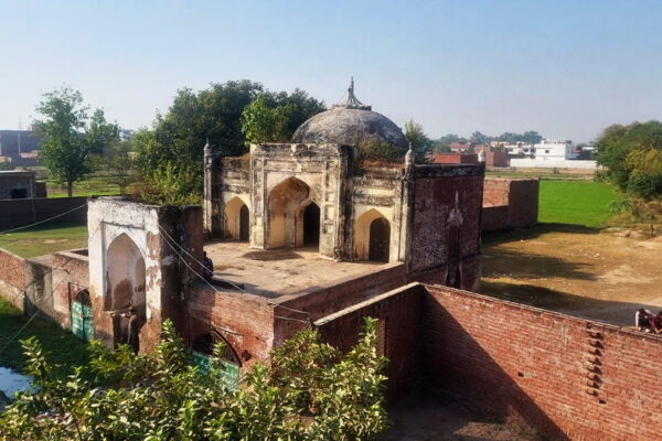
Gardens / Tombs

138. Delhi: When it was a district of Punjab
For some readers, this title would be intriguing. After all what Delhi, the capital of India for many centuries, has to do with Punjab. Moreover, in the popular imagination, Delhi and Punjab do not have much common in language and culture (that’s too is a misconception). But there is one close connection, which I would…

137. The Princely States of Punjab
The English reached the shores of India in 1608 at Surat. In 1612, the East India Company’s representatives met Emperor Jahangir and signed a commercial treaty. Gradually, they established “factories” (trading posts) at many places along the lengthy coast of India. For the next century, the British confined their activities to trade. However, by…
!")
135. Everchanging Borders of Punjab (Historical Geography of Punjab)!
Punjab is a historically significant region in northern India, also known as Hindustan. The term Punjab, meaning “land of five rivers” in Persian, came into common use after the Muslim conquest of the region. Its natural boundaries are generally considered to be the Indus River in the west, the Yamuna River in the east, the…

134. Borders of Pakistan
It is common knowledge that the state of Pakistan came into existence on 14 August 1947, following a long political struggle. Its creation was based on the two-nation theory, and on this principle, British India was divided into two separate countries. But have you ever wondered how and when the borders of this new state…
")
133. Demographics of Balochistan Province According to the Census of 1941 (Religions)
Balochistan (also spelled Baluchistan during the British Raj) was the farthest corner of the British Empire in India in every sense of the word. It was sparsely populated, far from the main centres of population, and located on the extreme western borders of India. The British began taking an interest in this area in the…

131. The Disputed States III: Junagadh
At the time of independence, as I have mentioned in my previous two posts, the issue of the accession of hundreds of princely states to India or Pakistan was very important and gave considerable trouble to both countries. In the previous two posts, I discussed some aspects of the Jammu & Kashmir and Hyderabad states….
")
130. The Disputed States II: Hyderabad State (Demographics 1941)
At the time of independence and partition of India, after Kashmir, the princely state which gave the most trouble to India was the State of Hyderabad of His Exalted Highness the Nizam of Hyderabad, Nawab Mir Osman Ali Khan, Asaf Jah VII. Out of almost 565 states, Hyderabad gave the most trouble to India after…
")
129. The Disputed States I : Jammu & Kashmir (Demographics 1941)
At the time of independence in 1947, British India had almost 565 princely states, constituting 23% of the total population and covering nearly 40% of its area. These states varied greatly in size and population. The biggest in population was Hyderabad with a population of over 16 million, while Jammu & Kashmir was the largest…

128. Demographics of North West Frontier Province According to the Census of 1941
The British reached this part of India in the mid-nineteenth century, when they defeated the Sikh state of Lahore in 1849. At that time, Hazara, the Peshawar Valley, and the areas east of Waziristan were part of the Sikh state of Lahore. The British granted provincial status to these newly conquered areas of Punjab. But…

127. Demographics of Sindh Province According to the Census of 1941
In October 2014, I wrote a post on the “Partition of Punjab in 1947” that proved to be the most popular of all my posts and drew the most comments as well. Some of the friends from the other side of the divide argued that so what if some Muslim majority Tehsils were awarded to India, as…